Too Big to Replace, Too Expensive to Tear Down: The Legacy of Urban Interstates
Atlanta: A City Divided
Interstate Ruler
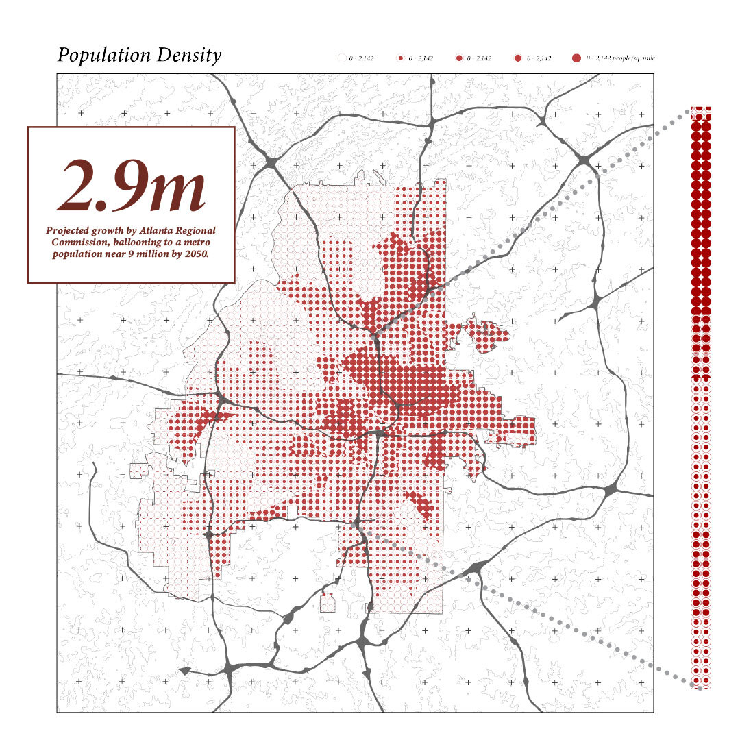
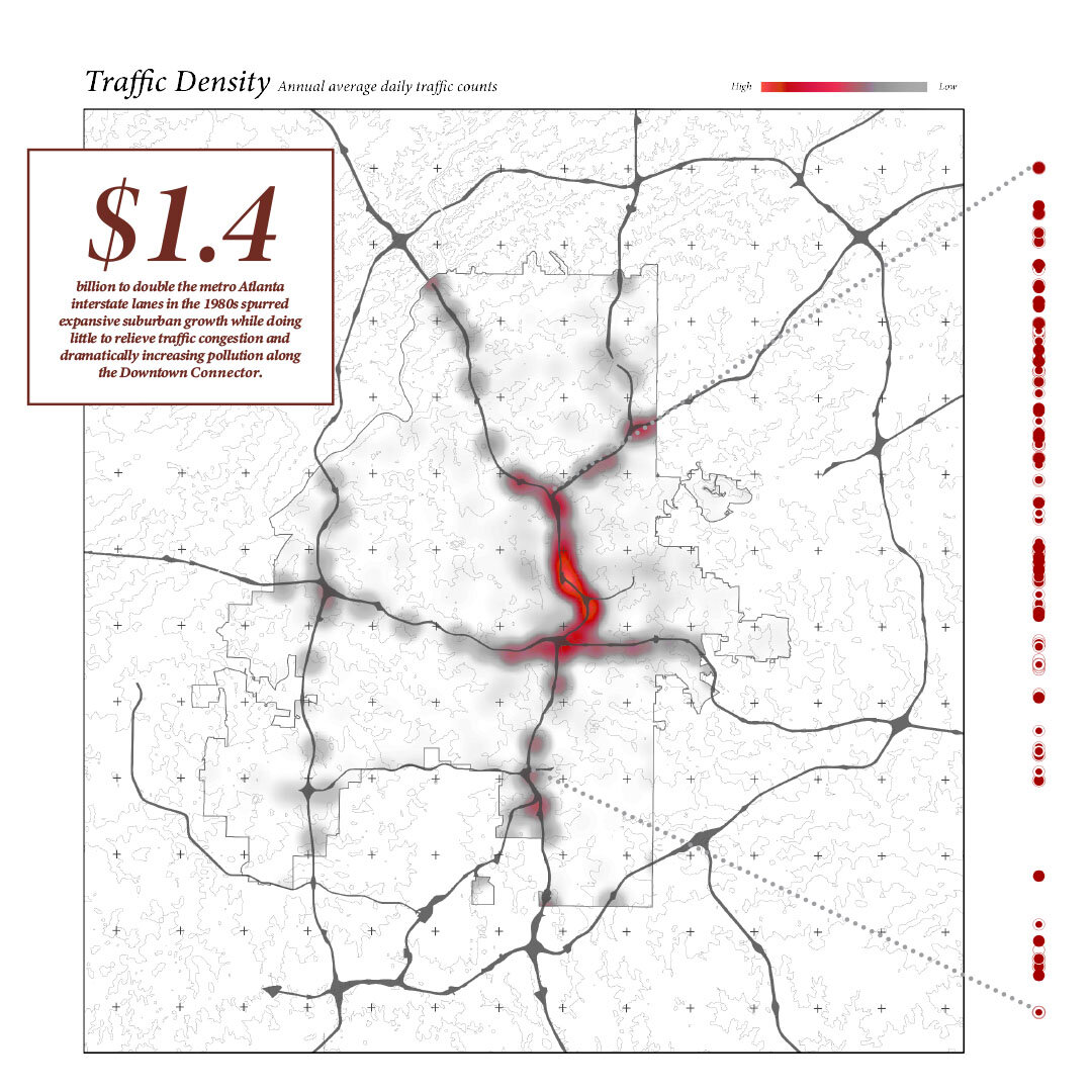
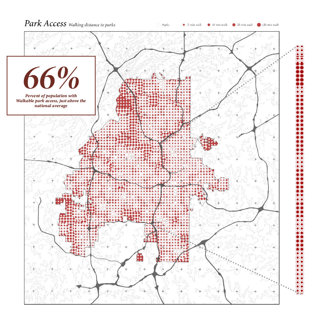
For decades, urban interstates have dramatically altered American cities and their social fabric. Civic centers, streets, blocks, and families have all felt the impact over time. Today, with political momentum and the prospect of federal funding, we have the opportunity to transform urban interstates into functional systems that prioritize the health and well-being of local residents. To begin this process, a city-level and highway corridor analysis has been developed, the Interstate Ruler, to visualize areas that would most benefit from the transformation of traditional single-purpose highways into multi-beneficial pieces of social infrastructure.


